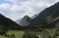
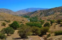
Alamedin gorge KG
The Alamedin valley is one of the 2 valleys supplying water to the city of Bishkek. It lies to the east of the Ala Archa valley.

The Alamedin valley is one of the 2 valleys supplying water to the city of Bishkek. It lies to the east of the Ala Archa valley.
Zarafshan is an ancient tributary of the Amu Darya, originates on the Zarafshan ridge, feeding on the meltwater of the Zarafshan glacier.
Lake situated in the neighboring valley of Sary-Chelek biosphere.
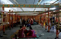
CBT Talas offers a good alternative to poor housing that can be found in the town of Talas.
Djarkorumdu is a valley on the foot of the Baba-Ata peak, on its South side. The glacial lake of Terme marks the spring of the river Djarkorumdu.
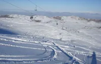
Small ski resort located between Alamedin gorge and the Issyk Ata gorge. There is one chair-lift of 1800 meter long for freerider.
Ovoot Airport is situated at Ovoot Tolgoi, Ömnögovi Province.
Mirankul mountains are 40 kilometers from Samarkand.
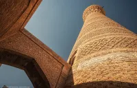
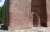
The Kalon Mosque or Kalan, which means "great Mosque", is the former main mosque of Bukhara in Uzbekistan.
This building is considered the tallest in all of Central Asia - the Tashkent TV Tower is 375 meters high, and its long sky-piercing spire can be s

On November 19, 2021, the grand opening of the Historical Museum in Bishkek, which was closed for reconstruction for five whole years,
Mary is the third largest city in Turkmenistan, situated in the Karakum desert.
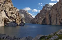
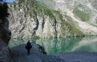
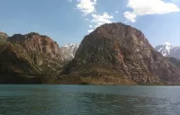
Kel-Suu (means lake of water) made for a long day of hiking or to spend a night in a tent.

The 4th city of the country is the economic center of northern Afghanistan, some 60 km south of the Uzbek city Termez.
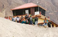
Small village above the Iskender's lake.
Margilan is a city in Fergana Province in eastern Uzbekistan. According to European legend, Margilan was founded by Alexander the Great.
Charvak Reservoir would be a simple artificial reservoir, if not for its emerald waters against the backdrop of beautiful nature, so harmoniously f
Madrassah of Barak Khan was built in the 16th century under the leadership of the ruler of Tashkent, Navruz Ahmadkhan, grandson of Ulugbek.
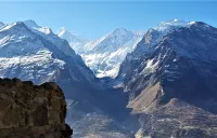
Diran Peak or Minapin Peak is a peak in the Karakoram range and the Rakaposhi massif.
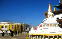
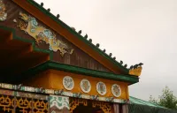
Ulaanbaatar (or formerly Ulan Bator) was founded in 1639 as an administrative center of Mongolian Buddhism.

Campsite in the National park of Terelj.
Join us on Facebook!
And keep updated with our tour promotions, or follow us on