Khujand International Airport TJ
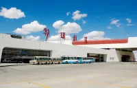
Khudjand International Airport is an airport serving Khujand, the second-largest city in Tajikistan.

Khudjand International Airport is an airport serving Khujand, the second-largest city in Tajikistan.
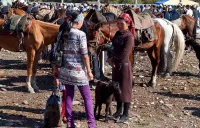
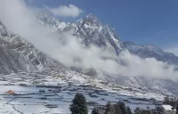
Village located in the Panj valley between Langar and Khorog. At the foot of the peak Saparodja (5864m).
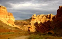
Charyn Canyon is a picturesque deep gorge in Kazakhstan, stretching for 154 km along the Charyn river valley, not far from the border with China an
Ust-Kamenogorsk is a large city in Eastern Kazakhstan, located on the Irtysh River at the foot of the Semipalatinsk Alatau mountain range.
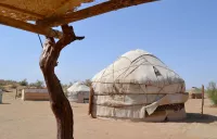
Campsite at the foot of Muztagh-Ata.
A large village in the Naryn Region of Kyrgyzstan, about 35km southwest of Naryn on the main highway to theTorugart Pass.
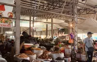
At the Osh market, you can find everything that may be necessary for life: traditional and trendy clothes, food of all kinds such as dried fruits o
The Djalpakbel pass is the link between the valley of Karakudjur and the valley of Karagoman.
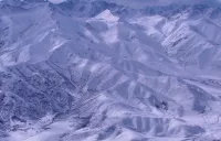
Mountains at foot of Kuksay (Kok-Say) 7184
The Karakol valley is fully part of the Karakol Natural Park.
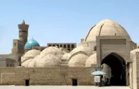
Inside Taki-Zargaron 36 shops and studios with warehouses.
The Naltar Valley is located 34 km from the town of Gilgit. Its nature is very rich and in 1975 a protected area was created.

The Aktau Chalk Mountains are the main attraction of Altyn Emel National Park after the Singing Barkhan.
Offer only a small surface lift but in development.
Local legends say that in ancient times the tribes living in Chong Kemin valley area used this hill to watch for any enemy tribes that might approa
Kara-Suu is a village in Kochkor District.

Pass linking the Sarez lake and Vikhinj with the Chapdara lake and Yashilkul lake (Alichur)
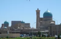
The Kalon minaret, built in the XII century from burnt brick, rises more than 46 meters, and its top is crowned by a conical lantern.
La ville a été fondée en 1958 et faisait partie de la région de Boukhara.
The architectural monument of the Sari Mazor Mausoleum is located in the city of Istaravshan in the Sughd region in the north of the Republic of Ta
Join us on Facebook!
And keep updated with our tour promotions, or follow us on